(Seton unfortunately never explored Baffin Island, but reading The Arctic Prairies inspired my interest in the far north, so in lieu of a Seton account, I offer my own.)
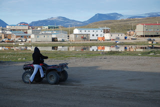
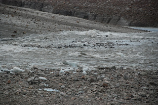
The eastern Arctic Inuit town of Pond Inlet, on Baffin Island, in the Canadian territory of Nunavut, west of Greenland, at 72° north latitude, experienced the unusual temperature of 72°F during the third week of July 2009. This was about twenty-five degrees warmer than is typical in one of the world’s northernmost towns. Many residents, walking, or driving four-wheelers, nonetheless remained dressed in their usual summer attire of hoodies or heavy jackets. The hot weather in “Pond” made no sense to residents or visitors. But the change has come. Mosquitoes, once a lesser problem, are now present in hordes and enthusiastic at the presence of visitors. Permanent snowfields have shrunk or disappeared. Mountain glaciers on Bylot Island, a few miles north of Pond, across Eclipse Sound, still reached the water three years ago, but now have retreated. Small rivers emerging from the Baffin glaciers have become raging torrents.
Most surprising, however, is the presence of thunder – in two forms. The summer of 2009 became the first when thunderstorms became a regular feature; previously, such storms were uncommon due to the cold conditions. Even more alarming is thunder in a second and more ominous form. Located at the center of the island, the Barnes Ice Cap is the largest ice feature outside Greenland and Antarctica. From beneath its massive surface can be heard the thundering sound of the collapse of its internal ice caves. In the central highlands where the Barnes is located, nighttime temperatures (in what passes for night under the twenty-four hour sun) dropped by less than 10 °F, making midnight high above the Arctic Circle warmer than midnight in Taos, New Mexico (36° north latitude). The Arctic, one of the world’s two massive air conditioners, is, as we know, blowing out less frigid air now than in decades past. But it is one thing to read about the changes, another to be roasting because of not having brought warm weather clothes for an Arctic gone mild.
A Plant Ecology Expedition
I made these observations during the summer 2009 as part of a plant ecology expedition titled Back to the Future (BTF). Funded by the National Science Foundation, BTF was part of the International Polar Year, research conducted by hundreds of scientists on changing conditions in the Polar Regions. Five researchers (four scientists plus me as photographer and contributing botanist) spent three weeks studying the flora of central Baffin. The group was led in the field by Dr. Craig Tweedie of the University of Texas (El Paso), and mentored by Dr. Patrick J. Webber, professor emeritus of plant biology at Michigan State University. Dr. Webber, now a resident of Taos, New Mexico, initiated the expedition. He first explored Baffin during the summers of 1963 and 1964 and over a long career has headed Arctic and alpine research organizations. Our expedition was a follow-up to his earlier ones, comparing current plant composition to that of forty-five years ago. I also took on “re-photography” taking pictures from the same perspective and at the same focal length as those taken in the 1960s.
The expedition studied two areas, a dry, Polar Desert plateau on the edge of the Barnes, and, near-by, one section of wetter, High Arctic habitat along the Isortoq River canyon (pronounced ee-sore-tok) which channels runoff from the western side of the ice cap to Foxe Basin, far to the west. The Barnes Ice Cap, at 2300 square miles (3700 square kilometers) is a super-glacier covering an area larger than Taos County where I live. At 70° north latitude, it is set in the middle of the world’s fifth largest island. Baffin Island covers an area larger than Kansas and New Mexico combined, supporting a mostly coastal population of fewer than 12,000. The treeless interior is a rock-strewn landscape of sparse vegetation, lichens with small patches of wildflowers, grasses, and sedges, similar in appearance to the more stark areas of the Rockies.
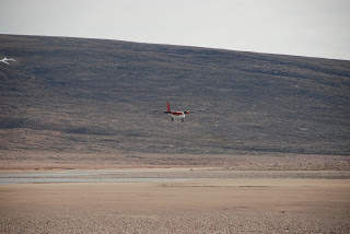
There are no roads or man-made structures of any kind for the entire 170-mile distance from Pond to the Barnes Ice Cap. Access over the dozens of deep canyons, glaciers, lakes, and flooding rivers is by air. We flew out from Pond aboard a Twin Otter – two strong engines attached to a stout body. Known as the workhorse of the North, the Twin Otter can carry a big load and, with balloon tires, can land in most unpromising locations. The airplane passed through several storms before emerging from clouds above the Isortoq. The pilots swept down low over the river several times, making sharp turns within the canyon walls as they searched for a place to land. After several brief touchdowns to determine surface conditions, they chose a long gravel-bar island along the main river channel, bumping down hard and stopping abruptly, seemingly in not much more space than a heavy truck would take to stop from similar speed.
Glaciers of Baffin Island
Until the last century, much of central Baffin was heavily glaciated, making travel impossible. There are a few caribou, wolves, ermine, foxes, hares, and jaegers, but overall, not many animals. With limited hunting and fishing opportunities, human visitors have been scarce or absent. Elsewhere on the island are found stone tent rings and, Inuksuit, stone assemblages that serve as markers for hunting areas, overland routes and sacred sites. The only signs of human presence near the Isortoq are abandoned camping supplies and rock cairns left by the small number of recent explorers. I found no record of anyone having navigated the entire length of the Isortoq by raft or kayak. Its reputed stretches of class five rapids will no doubt someday attract the skilled and the foolhardy.
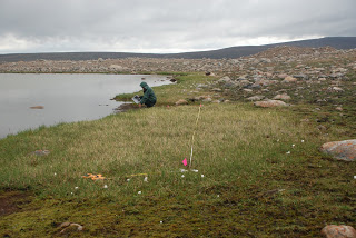
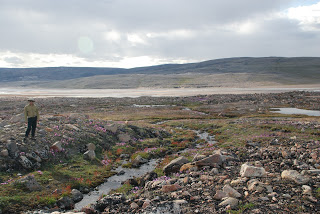
We twice crossed the wide Isortoq by raft, examining both sides of the river, hiking its barren shores, then climbing above its banks to grassy valleys spotted with glacial ponds. Higher still are endless felsenmeer (rock fields) crossed by swift streams too large to wade, too small to raft or kayak. Along the way we found swaths of large-blossomed purple Epilobium near drifts of cotton-grass looking like left-over snow. Narrow canyons, whose bottoms were entirely covered by blood red and bright green mosses, survive beneath unstable rocky moraines as high as five story buildings. Our goal was to relocate, re-photograph, and re-sample eighty-one plots, established in the sixties, and not visited again until this past summer. Each plot measured 1 x 30 meters. The scientists noted the species found in each to compare current plant composition with what was found in decades earlier. Species composition had clearly changed. (The analysis is still ongoing.) To do this kind of work, botanists spend a good deal of time looking at the ground. But from many places, when we looked up, we saw the ice cap.
Barnes Ice Cap
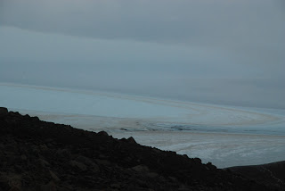
Both its floodwaters and its sheer mass make the Barnes Ice Cap a looming presence. The Pleistocene-era ice at the base of the Barnes may go back 100,000 years, and, in places, it is more than two thousand feet thick. The ice cap is a remnant of the Laurentide ice sheet, which at its greatest, extended from Baffin to central Kansas. The ghostly ice mass constantly changes color under the twenty-four hour sun. Under clear sky, it can appear as an expected undifferentiated white, but it can also seem yellow and textured like a desert hillside. At other times, it exhibits what only can be described as an electric blue that to all appearances seems to be glowing from within. As the Laurentide, the ice mass was a controlling factor of global weather. As the Barnes, it gives gusty reminders of its past glory by hurling forth katabatic winds, short strong bursts of down-slope refrigerated air. Its coming death matters even to those who will never know its winds. As melt the glaciers of Baffin, so also will melt the gigantic ice sheet covering Greenland. The realm of ice – the cryosphere – at least on Baffin, is in a major transition of energy loss. In any system, the end point of energy loss is death.
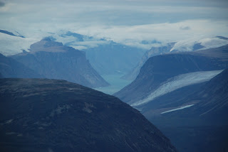
The cryosphere should not look as if it is alive. But the inescapable impression from thirty thousand feet above (as well as on the ground) is that the ice realm of our planet demonstrates life-like characteristics. Individual glaciers wrap over high ridges like thrown drapery, then crowd through deep canyons, dirty white striped ribbons whose motion is evident – like a fast stream caught in the millisecond image of a photograph. Glaciers plunge over cliffs into the sea fog covered fiords. On the horizon white capped mountains and hovering grayish clouds blend to obscure the line between the ice cryosphere and the icy atmosphere.
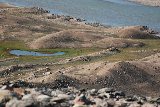
This was nowhere more evident than from the drained basin of Flitaway Lake where stranded, dirt-covered ice burgs form hundred-foot pyramids, contrasting dramatically with the ice cap that rises mountain-like behind. In 1963, Flitaway was a glacial lake covering a thousand acres and reaching more than two hundred feet deep. Its dam was the ice cap itself until one day within the last couple of decades (no one seems to know just when) instability in the ice or ground caused most of the water to drain away. Scores of rivulets run down the ice cap, splashing into what is left of the lake. The continual sound of waterfalls is punctuated by the loud collapse of the invisible ice caverns, giving the impression that the Barnes is rotting from within.
Lewis Glacier
A few hours south (by foot), the ice cap pushes outward as the Lewis and Triangle glaciers. Once the two were connected, flowing all the way to the Isortoq. By 2009, the Triangle had retreated far back towards the ice cap. Melt water drops so fast and violently through its steep, twin canyons that the resulting turbulence roars at a frequency similar to that of a Twin Otter. Lewis Glacier descends a canyon of lesser slope. Its terminus shoves downward into the earth on the south and forms tall ice walls on its north. Over time those walls melt and collapse, sometimes exposing ice caves. Dr. Webber photographed the revealed caves in 1964. One photo shows a smiling scientist standing against a white wall of unknown height, apparently unconcerned that a section of the cryosphere might well give way to gravity at any second. Another photo bears the caption: “Large enough to park a double-decker English bus.”
Those ice structures melted long ago, victim of the glacier’s one-mile retreat. I crossed the now ice free spot where they stood forty-five years ago. The melted glacier left behind a boulder-strewn flood plain. Nearing its current end point, the land below the glacier is unsettled into huge piles of churned-up rock rubble where even the ever-present Baffin lichens have not yet found a foothold. The crumbling moraines are undermined by permafrost in decay, creating the kind of trap that wooly mammoths used to stumble into.
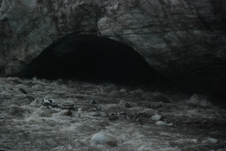
The ice walls of 2009 look much like those of 1964, even though they are in a different place. But there was a difference: Part of the Lewis River, which used to emerge from beneath the glacier, now floods along its side. In one spot, the river has carved a tunnel through the ice wall where it quickly disappears into complete darkness. Although entry into the cave was not more than fifty yards away, the furious downward slide of the river made it impossible to cross. It looked alive and very dangerous, the dynamic nature of the scene increased still further by the arrival of a thunderstorm with its attendant lightning – a scene that could have been taken out of The Lord of the Rings.
The Glacier Bleeds Out
The massive flow of water is the lifeblood of the glacier. Old photos showed the Lewis as a monster of ice; now it is much reduced in stature and in a few years will disappear back into the edge of the ice cap itself. Walking on just-revealed earth, ground never before touched by any human, I was watching liquid history, ice formed thousands of years ago, now melted into the water passing swiftly by. The water level pulsed to a higher level once each day, for about seven hours, before, in the evening, subsiding again – the glacial heartbeat.
The hidden ice caverns must be fantastical, the realm of ever-change. Its rivers pulse through like veins of blood, although those sibilant streams do not bring life to the ice mass; they are more like the hemorrhaging of a wound. The interior thunder suggests that its many passages are growing in size causing it to bleed out – the cryosphere equivalent of the Ebola virus. The arterial outflow from its slowly beating heart carries an unmistakable question. When its great heart stops, what will become of us?
Featured image: Pond Inlet, Nunavut (David L. Witt)

