{In late July and early August 2015 I led an expedition to the Arctic region of Canada’s Northwest Territories researching the Ernest Thompson Seton and Edward Preble expedition of 1907. We followed their route around Aylmer Lake located northeast of Great Slave Lake. Field notes from the expedition plus photographs are presented here in several separate entries. Additional essays about our journey can be found at the Seton Expedition website and at davidlwitt.com. An exhibition and short film about the 1907 and 2015 expeditions will be premiered at the Seton Gallery of the Academy for the Love of Learning (sponsor of this project) on August 14, 2016.}
Tuesday July 28, 2015
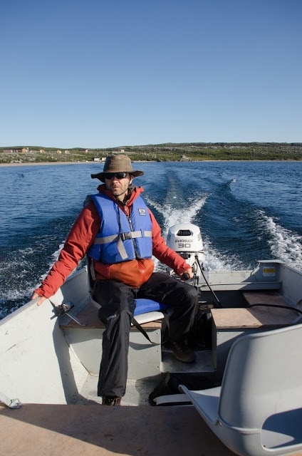
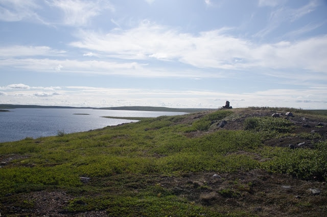
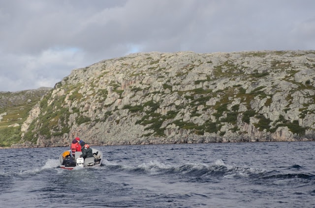
We took two boats on all excursions. I asked Thomas to learn the basics of outboard motor operation (Evenrude 30hp, 16’ (4.9m) aluminum fishing boat). That first day he and I went in one boat, Kevin, Michale & Patty in the other. Took off at 9:00am, south out of Rocknest Bay then east through Thanakoie Narrows, much of the way towards Clinton-Colden Lake to where an island nearly blocks passage. We were searching for a cairn Seton built while camped there. Thrilling to see that it was still there; it could be seen from approximately a mile away, long before we could make out the course of the Narrows. We would find this distant look surprising since the cairn is just below the island summit on the east side and is little more than a meter high. (We entered western edge of the Narrows at 9:30am.)
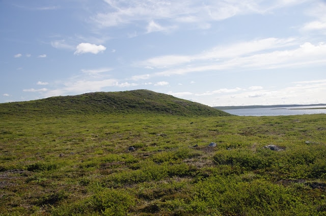
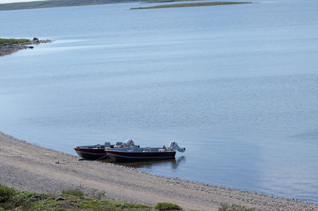
The water on the south side of island is very shallow. The north side has a narrow but passable channel. We landed on a small west-facing beach, and then climbed over an embankment onto the tundra. This turned out to be the only part of the island that seems suitable for camping. Seton and Preble set up camp in one spot, thereafter moved to another during the extended time they were stranded due to stormy weather. Perhaps it is here where they rode out the stormy weather in 1907. (We found a second cairn near our landing site, but Seton/Preble accounts mention only the one on top.)
We climbed hill towards its summit (me in the lead of course), Thomas following with video camera. Hill gets steeper near the top. Reached cairn at 10:15am. Very exciting for me, finding this cairn built by ETS during the layover, keeping them from exiting into Clinton-Colden when they had expected to do so.
Cairn Location: N 64° 03’ 53.2” W107° 55’ 58.8”
Elevation: 1260’ (384m) Sandhill Island (English for Thanakoie)
After much picture taking, I made a brief botany survey and a solo reconnaissance of 1/3 of the island (western and southern sections, including finding several different habitats). We documented the beautiful views (in all directions) before leaving the island at 1:00pm. Clear weather, moderate breeze at island summit.
Continued north along the cove shore, stopping at an arc of sandy beach. In the willows at our landing site, the debris remains of a small, long abandoned shack. North reach of the beach showed fresh 3 ½” wolf track -wolf track – 
Temperature 70°F (21° C).
Took off again after a pleasant time on sand esker above the beach. 2:55pm watched loon diving near boats. 3:20-4:00pm stopped at a rocky point where we found a metal geological survey marker embedded in rock, dated 1924. It included a warning that anyone disturbing the marker could expect to be punished with prison time. We left it alone and returned from there to the Lodge.
Note: ETS/EAP on Sandhill Island Aug 24-28 1907. Must have been quite a headwind. There are no comfortable camping spots on the island. We did not find any tent ring rocks. The island is important (as noted by ETS) as a Caribou crossing point given the narrow water leads on either side. On my tour of the island I found several north-south Caribou paths, although no sign of recent passage. Caribou were crossing there in August 1907.
The summit Seton cairn was noted by David Morrison in 1982. (He did not mention the shoreline cairn.) “Report on Archaeological Survey of the Middle Lockhart River System, NWT.” Photocopy of 1982 field notes, Canadian Museum of Civilization, (pg. 2): description of Lockhart River system. Morrison studied archaeology of Thanakoie Narrows northward; he studied the area from Sandhill Bay to Sussex Lake (covering some or much of the same territory as ETS/EAP), starting July 9, 1982 and continuing for 3 weeks before continuing their research south of Aylmer. He refers to the site we visited today as “Sandhill Island” which in Yellowknife Chipewyan language refers specifically to this island. The name seems to pre-date Back’s 1836 expedition. The summit of Sandhill is 35m above rive. Morrison described the Seton monument: “Originally one of the stones was inscribed ‘Seton Exp. 25 Aug 07’ but some passing traveler has since removed it. The cairn is located at the apex of the hill.” Sandhill is “an esker knob island.” [Note: the island had seen very recent visitors, within days of our visit, at least two people had left their unburied excrement at the western end of the summit ridge. Perhaps the two Japanese tourists who were said to have visited eastern Aylmer Lake just before our arrival.]
Night spent at the Lodge.
Wednesday July 29, 2015
Up at 6:15am. Packing for Lockhart trip. Longest single excursion of the trip, including crossing a wide stretch of open water Aylmer.
9:42am left Aylmer Lodge dock. 9:52 Peregrine falcon flew parallel to the boats (before going faster and moving on) as we passed through the strait from Rocknest Bay to Aylmer. Pic#5164 Looking to the west from main section of the lake; west end too far away to see. #5160 Terraced Hill (from ETS map). #5165, 5166 Sandy Bay, from a distance (from ETS map). #5169 Harbor Island (the huge one with U-shaped bay in the middle of Aylmer).
Note: August 1907: they paddle west, unable to see end of the lake, believing for all this size, that a larger part of the lake still lay ahead. They had no way of knowing that they were already crossing the largest part. From here, there is no way of estimating how far off the west end might be.
10:50am Pulling away from Harbor Island into the largest stretch of open water on Aylmer. Daunting in a 16’ motorized fishing boat on a good weather day. But in a canoe, on a day when a storm might rise unexpectedly? Dangerous.
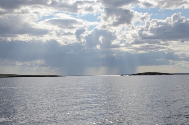
For us: Water choppy but not dangerous. One twenty minute period passed with nearest shore kilometers away while the far west and east horizons were just water; north and south were no more than suggestions of land, a dark line of low distant hills. Lake seems very big, the sky of the unlimited vast.
Boat speed 18mph for 20 minutes of the open water.
12:05pm Landed on beach protected by large rocks. Musk Ox tracks in the sand, but not fresh. Wolf tracks (recent, large) and lots of fox tracks, a regular highway for the latter. I led us inland to look for the Musk Ox boulders, but took us much too far inland over difficult tundra walking conditions. Lots of hidden holes in the hummocky ground hidden by vegetation. Seton had also done a good deal of walking in this region so we replicated the walk but apparently not the right course. Based on a 1907 photograph, we searched for a distinctive juxtaposition of two large boulders from where they killed a Musk Ox. My intention was to find those rocks and recreate the scene (without killing anything). But wherever those boulders might be, we could not find them.
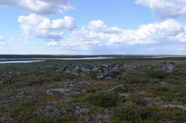
Eventually we veered west looking for the Thonokied River with faint hope of finding a cairn ETS might have built there. There are rocks piled everywhere (by wild nature) on the ridgeline overlooking the river as grand at ETS described it. Maybe we should have gone further north, but we were getting tired and hot with almost no chance of finding any sign of his presence. The walk was more tiring than fun; we failed to find anything but a fine view. (I noted in the field journal that this hike was hardly worth the effort. But conditions there did replicate what ETS went through, so we had the experience if not the results to show for our efforts.)
Kevin and Michale took one path back, Patty another. Thomas and I continued south along the river. I eventually turned back east, alone, while Thomas continued down the river towards the lake. All of us eventually reached the lake shoreline, but inexplicably managed to miss the boats, going too far east until Kevin realized our mistake and headed us back in the right direction. We finally got back to the boats around 4:30. I accidentally left my magnetic clip on sunglasses behind somewhere on this trek for future explorers to find.
5:10pm Finally underway again after taking considerable time negotiating our way past the blocking rocks creating a treacherous maze. This would have been easier for a canoe, or perhaps they landed somewhere else—but our landing point was the only sand beach along the Musk Ox camp shore. Seton’s map seemed to indicate this spot, but without finding the distinctive double-boulder, we simple could not know. A few spitting rain showers marked our exit.
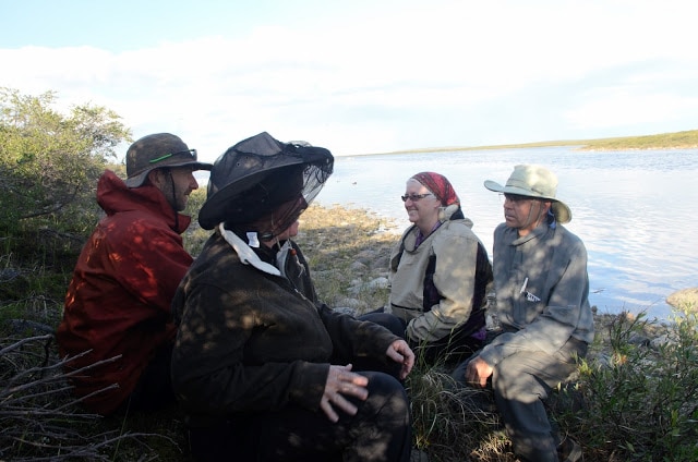
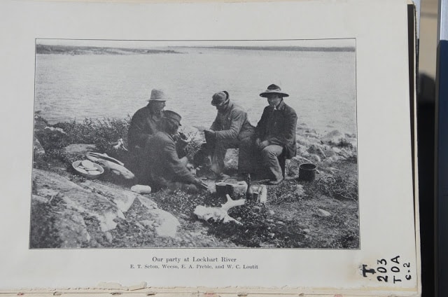
Lockhart River mouth. We continued west to the end of the lake where enters the Lockhart River. We looked for another rock cairn Seton built there. Although a point of rocky land jutting into the river seemed like the right spot no cairn was visible. We landed on the north shore of the river, on an incline of slab rocks, one of the few accessible places, and likely the exact spot where ETS/EAP landed. We quickly found a place on or near where Seton took a group photograph of them having dinner. Kevin photographed the four of us in the same place. In the willow overgrown shore (the willows weren’t there in Seton’s time) near our boats, Kevin found a rusted kerosene can—4 Imperial Gallons—almost certainly left by ETS. Kevin agreed to hold it at the Lodge for temporary safe keeping. Perhaps a Canadian museum will want it someday.
Dinner spot location: N 64° 03’ 88.44” W 109° 13’ 30”
7:25pm Continued boating upstream to a rapids (probably farthest ETS went west by water). The other boat trolling for fish. We later returned east looking for a camping spot for us finding nothing suitable. I suspect that both the 1907 camping spot and the cairn may have been made on the rocky point jutting into the river, dividing the Lockhart from Aylmer. Thomas made a brief reconnaissance there but found nothing due to the thick brush and the protective mosquitoes.
We continued over 1k (1094 yards) east along the south shore of the lake until coming upon a lovely beach in a protected cove giving onto a dramatic view to the west. Camp set up 9:30pm. (ETS/EAP followed the north shore on their way to the Lockhart and perhaps also on the way out so did not camp here.)
Camp location: N 64° 03’ 88.44” W 109° 13’ 30”
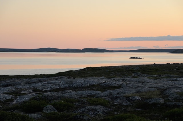
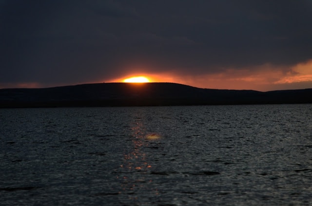
Sheltered from the east and to some extent from north we experienced a windless sunset, calm water. The sun set over flat lake as the one-night-before full moon rose simultaneously over low hills. Spectacular color, long lingering setting sun, occasionally shining through clouds, finally disappearing 10:17pm. Turned in at 12am.
Thursday July 30 (see pg. 20 field notes)
Up at 7am. Blue sky. Stiff breeze. 50°sF (10°C)
10:35 Returned to Lockhart River, continued search for cairn. We landed in the same spot and then walked north up the hill (the route shown by ETS on his map) and, after stopping for blueberries of which there were too many to ignore, attained the ridge between Aylmer and Outram Lakes. Cloud cover increased to 70%; lake water at its most choppy.
I continued west to reach the summit overlook between the two lakes. Michale soon followed, and later, the others. Elevation there is 1355’ (407m), the highest point of our entire trip. ETS expedition went up there to find what we found: A view proving they had reached the west end of Aylmer and a view to the Outram Lakes. Southside of Lockhart R basin heavily vegetated with few boulders; north side rocky: a strongly defined dividing line.
Upon reaching the ridge (easy hike) ETS must have climbed this very rock, around 7’ (2.1m) high. From its top: a great 360° view of the surrounding tundra.
Location: N 64° 03’ 55.9” W 109° 14’ 14.5”
ETS then continued down the ridge going west; we did not follow farther than the rock overlook.
1:45pm We took off from shore, heading east once more from the Lockhart to our beach camp, not arriving until 3:15 due to slow trolling on the way back.
So far: Success at Lockhart River and at Thanakoie Narrows finding part of what we came for, but less successful at Thonokied site (although we re-photographed the river shoreline in approximately the same area as the ETS photo). We believe it more likely than not that the Lockhart cairn did not survive. It would, however be worth another look early or late in the season when the willow thicket might be more manageable (fewer leaves, fewer mosquitoes).
Dinner that night: more Lake Trout + one Arctic Grayling (a river fish caught along the Lockhart), fried potatoes and onions. Kale, apple & other vegs salad. About 50°F (10°C) at 10:30pm. Dead silent. No waves. No wind. Flock of loon chicks floated by point of land north end of beach (around dinner time), near my tent. The hillside east of the camp is not covered with willows but is of smooth ground with short vegetation. We did not hike this but wanted to do so.
Friday July 31, 2015
8:55am We left camp, heading east along the shoreline before turning north across the lake. Our destination was a place a called Cliff Camp, a prominent rock face rising out of the water where Seton & Preble were forced to take shelter from another storm on their way west to the Lockhart. Here the lake forms a cove in the middle of which is a round island offshore from the largest cliff along this part of the lake. The steep rocky shore included no obvious landing site so camping here would not have been good anything more than emergency shelter. We did not land.
Off shore location: N 64° 06’ 29.7” W 109° 03’ 08.3”
We circumnavigated small island in the bay. Spotted a falcon on the cliff, gulls in the air, and loon chicks around the island.
10:20am We returned to the Thonokied River, this time entering the river by boat although not getting any further than its mouth due to rapids and low water. Stopped there to search for exact spot to take the re-photo Seton called “SW across Earl Gray River.” We were able to line up the far shore into what looked like the correct perspective, but we could not find matching rocks on the shore (east) where we were walking. Took several photos to at least approximate the 1907 scene. Fairly fresh Musk Ox tracks near where we landed. Light short rains there and earlier at our beach camp. Cruised slowly along Musk Ox shoreline looking closely for the double-boulder that we did not find. Back at Lodge before 3:30pm.
ALL COPYRIGHTS RESERVED.

